
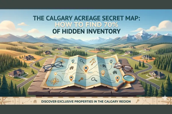
The Calgary Acreage Secret Map: How to Find 70% of Hidden Inventory

The Calgary Acreage Secret Map: How to Find 70% of Hidden Inventory
Introduction
You're searching for acreage properties around Calgary.
You go to Realtor.ca or MLS. You enter your search criteria:
Location: Within 30 km of Calgary
Property type: Acreage/Rural
Price range: $500,000-$800,000
Minimum lot size: 2 acres
The search returns 18 properties.
You think: "Is this really all that's available? Only 18 acreage properties in my target area?"
You tour a few. None of them are quite right. You keep waiting for new listings. Weeks go by. A couple new properties appear. They're not right either.
You start to think: "Maybe acreage properties are just really scarce. Maybe we need to expand our budget or compromise on our criteria."
But here's the reality you don't know:
There are actually 180+ acreage properties in your target area right now.
You're only seeing 18 because you're using standard MLS search tools that miss 70% of the available inventory.
There's a "secret map" — or more accurately, a set of public but overlooked resources — that reveals the full acreage market around Calgary:
Municipal GIS (Geographic Information System) databases.
These online mapping tools, maintained by Rocky View County, Foothills County, the City of Calgary, and other municipalities, show:
Every rural and agricultural property parcel
Exact zoning classifications
Lot sizes and boundaries
Subdivision potential
Historical land use
Infrastructure proximity
Development restrictions
And they're free. Public. Accessible to anyone.
But 95% of acreage buyers don't know they exist.
This post reveals The Calgary Acreage Secret Map: how to access municipal GIS databases, what critical information they provide that MLS doesn't, how to use them to find hidden inventory, and why this tool is essential for any serious acreage buyer.
Why Standard MLS Searches Miss 70% of Acreage Inventory
Let's start by understanding why MLS alone is insufficient for acreage searches.
Problem 1: Inconsistent Listing Categories
How Sellers List Acreage Properties:
Some sellers list acreages as:
"Acreage/Farm"
"Rural Residential"
"Country Residential"
"Agricultural"
"Residential Detached" (with large lot size)
"Vacant Land"
The Issue:
If you search for "Acreage/Farm," you miss properties listed as "Rural Residential" or "Residential Detached with 5-acre lot."
There's no standardized category, so searches miss properties based on how the listing agent categorized them.
Problem 2: Off-Market and Private Sales
Many Acreage Properties Never Hit MLS:
Private sales: Owner sells to neighbor, family member, or through word-of-mouth
Pocket listings: Agent has buyer clients and never lists publicly
For Sale By Owner (FSBO): Owner lists on Kijiji, Facebook, or puts a sign on the property but doesn't pay for MLS listing
Estate sales: Property in probate, heirs haven't listed yet but will sell if approached
Estimate: 20-30% of acreage transactions happen off-market.
If you only search MLS, you miss these entirely.
Problem 3: Properties Listed in Adjacent Municipalities
Calgary-Area Acreage Properties Span Multiple Jurisdictions:
Rocky View County (north, west, east of Calgary)
Foothills County (south)
Wheatland County (east)
City of Calgary (some rural-designated lands within city limits)
Town of Okotoks, Airdrie, Cochrane, Chestermere (some acreage/rural properties)
The Issue:
MLS search by "Calgary" might miss properties technically in Rocky View County even though they're 15 minutes from Calgary.
Buyers search one jurisdiction at a time and miss properties across municipal boundaries.
Problem 4: No Detailed Zoning or Land Use Information
MLS Listing Information:
Address (sometimes vague for rural properties)
Lot size (acres or sq ft)
Price
Photo of house (if house exists)
Basic description
What MLS Doesn't Tell You:
Exact zoning: Agricultural? Rural Residential? Country Residential? Each has different regulations.
Subdivision potential: Can you divide the land in the future?
Land use restrictions: Can you have horses? Chickens? Home-based business? Outbuildings?
Historical land use: Was this a former industrial site? Contaminated soil? Previous agricultural operations?
Infrastructure proximity: How far is municipal water/sewer? Electrical service? Road access?
Why This Matters:
Two properties both listed as "5 acres, rural, $600,000" look identical on MLS.
One is zoned Agricultural (can subdivide, have horses, build shop). One is zoned Rural Residential with restrictive covenant (no horses, no subdivision, strict architectural controls).
Same price, completely different value and potential.
MLS doesn't reveal this. You only find out after requesting zoning information from the municipality or viewing the property.
The Secret Map: Municipal GIS Databases
Here's the tool that reveals the full acreage market: Municipal GIS (Geographic Information System) databases.
What Is GIS?
GIS = Geographic Information System
It's an online mapping platform that displays property parcels with layers of information:
Property boundaries
Lot sizes
Zoning classifications
Land use designations
Infrastructure (roads, utilities, water bodies)
Environmental features (wetlands, flood zones)
Historical data
Every municipality in Alberta maintains a GIS database for planning, assessment, and public access.
Key GIS Databases for Calgary-Area Acreage Buyers
1. Rocky View County GIS
URL: https://maps.rockyview.ca
What It Shows:
Rocky View County surrounds Calgary on the north, west, and east. It contains the majority of acreage properties within 30-40 minutes of Calgary.
GIS Layers:
Property parcels: Every lot and parcel in the county
Zoning: Agricultural, Country Residential, Rural, etc.
Land Use Bylaw: Permitted uses for each zone
Assessment roll: Property ownership and assessed value
Utilities: Water/sewer service areas, electrical infrastructure
Environmental: Wetlands, floodplains, environmentally sensitive areas
Development permits: Recent and pending development applications
How to Use It:
Zoom to your target area (e.g., Springbank, Bearspaw, Langdon)
Click on property parcels to see:
Legal land description
Lot size
Zoning
Assessed value
Owner name (sometimes)
Filter by zoning (e.g., show only "Agricultural" parcels)
Identify properties that meet your criteria
What You Discover:
You find 100+ agricultural or country residential parcels in your target area — many not currently listed on MLS but potentially available if you approach the owner or wait for future listings.
2. Foothills County GIS
URL: https://maps.foothills.ca
What It Shows:
Foothills County is south of Calgary and includes areas near Okotoks, Black Diamond, Turner Valley, and Priddis.
GIS Layers:
Property parcels and boundaries
Zoning and land use
Assessment information
Road networks and infrastructure
Environmental features
How to Use It:
Same process as Rocky View: zoom to target area, click on parcels, review zoning and lot sizes, identify properties matching your criteria.
3. City of Calgary GIS (for Rural Lands Within City Limits)
What It Shows:
Some areas within Calgary city limits are still designated as rural or agricultural (particularly in the far south, southeast, and northwest).
GIS Layers:
Land use districts (including rural/agricultural)
Future development plans
Annexation areas
Utilities and infrastructure
How to Use It:
Search for properties designated as "Agricultural" or "Rural" within Calgary. These are rare but exist.
4. Additional Municipal GIS Databases
Wheatland County: https://maps.wheatlandcounty.ca (east of Calgary, Strathmore area)
MD of Bighorn: (west toward mountains, Cochrane/Bragg Creek area)
Town of Okotoks, Airdrie, Cochrane, Chestermere: Each has GIS or planning maps showing acreage/rural properties within town limits or fringe areas.
What GIS Reveals That MLS Doesn't
Critical Data Point 1: Exact Zoning Classification
Why It Matters:
Zoning determines what you can do with the property:
What animals are permitted (horses, chickens, cattle)
What structures you can build (barns, shops, guest houses)
Whether you can subdivide the land
Whether you can operate a home-based business
Setback requirements from property lines
Example Zoning Types in Rocky View County:
Agricultural District:
Minimum lot size: 32 hectares (80 acres) for subdivision
Permitted uses: Farming, ranching, single-family dwelling, farm buildings
Animals: Unlimited livestock
Home business: Agricultural-related businesses permitted
Country Residential District:
Minimum lot size: 0.8-2 hectares (2-5 acres) for subdivision
Permitted uses: Single-family dwelling, small-scale agriculture, accessory buildings
Animals: Limited livestock (varies by specific district)
Home business: Some home-based businesses permitted with development permit
Rural District:
Minimum lot size: 16 hectares (40 acres) for subdivision
Permitted uses: Farming, single-family dwelling, rural industrial uses
Animals: Livestock permitted
Home business: Agricultural and rural-related businesses
Direct Control District:
Varies widely — custom zoning for specific developments
Must review specific bylaw to understand permitted uses
What MLS Shows:
"Zoning: Agricultural" or "Zoning: Rural"
What GIS Shows:
Exact district code (e.g., "Agricultural District (AG)") with link to full Land Use Bylaw detailing all permitted and discretionary uses, setbacks, and regulations.
Critical Data Point 2: Subdivision Potential
Why It Matters:
Can you divide your 10-acre property into two 5-acre parcels in the future?
Subdivision potential affects:
Future flexibility (sell half, keep half)
Property value (subdividable land worth more)
Estate planning (divide among heirs)
What GIS Shows:
Minimum lot size for subdivision in that zoning district
Municipal development plan designations (some areas prohibited from subdivision)
Existing lot dimensions (does lot meet minimum frontage/depth requirements?)
Example:
You're looking at a 10-acre property.
GIS reveals:
Zoned "Country Residential"
Minimum lot size for subdivision: 2 acres
Current lot dimensions: 200m x 200m (meets minimum frontage requirements)
Conclusion: Property could potentially be subdivided into 4-5 lots (subject to development approval)
Value Implication:
This property is worth more than a 10-acre property zoned Agricultural (80-acre minimum for subdivision = cannot subdivide).
MLS doesn't tell you this. GIS does.
Critical Data Point 3: Historical Land Use
Why It Matters:
Previous land use can create issues:
Former industrial sites: Soil contamination, groundwater contamination
Former fuel storage: Underground tanks, spills
Former livestock operations: Manure storage sites, nutrient loading
Former landfills: Settling, methane gas, restricted development
What GIS Shows:
Historical air photos (see what property looked like in 1950s, 1970s, 1990s, 2000s)
Previous development permits and land uses
Environmental assessments (if required)
Example:
Property looks like vacant land. Beautiful 5 acres. Clean.
GIS historical air photos reveal:
1970s-1990s: Property had large industrial buildings
2000: Buildings demolished
2005: Environmental remediation work (visible disturbed soil)
Red flag: Former industrial site. Requires Phase I/Phase II environmental assessment before purchase to ensure no contamination.
MLS listing doesn't mention this. GIS historical layers reveal it.
Critical Data Point 4: Infrastructure Proximity
Why It Matters:
Distance to municipal water/sewer and electrical service determines:
Whether you need well and septic (and costs)
Cost to extend electrical service ($50,000-$150,000 if far from service)
Future development potential (municipal services increase value)
What GIS Shows:
Water service boundaries (areas with municipal water available)
Sewer service boundaries (areas with municipal sewer available)
Electrical infrastructure (high-voltage lines, substations)
Road classifications (paved, gravel, private)
Example:
Property is 2 km from nearest municipal water line.
GIS reveals:
Municipal water extension would cost ~$400,000 (prohibitively expensive)
Conclusion: You'll need a private well ($20,000-$35,000)
This affects your total cost and should be factored into offer price.
Critical Data Point 5: Environmental Constraints
Why It Matters:
Environmental features restrict development:
Wetlands: Cannot build within setback distance (often 30-100 meters)
Floodplains: Restricted building, insurance issues
Environmentally sensitive areas: Protected habitat, development restrictions
What GIS Shows:
Wetland inventory (mapped wetlands with buffer zones)
Floodplain maps (100-year flood risk areas)
Environmental reserves and protected areas
Example:
Beautiful 5-acre property with stream running through it.
GIS reveals:
Stream has 30-meter riparian setback on each side
60 meters of property width is unbuildable
Reduces usable building area significantly
Impact: This property has less development potential than it appears. Should affect offer price.
How to Use GIS to Find Hidden Acreage Inventory
Here's the step-by-step process to use GIS databases to find properties that aren't showing up on MLS.
Step 1: Define Your Target Area
Map Your Ideal Locations:
Within X minutes of Calgary
Specific communities (Springbank, Bearspaw, Priddis, Langdon, etc.)
Proximity to schools, work, amenities
Identify Which Municipality:
North/West/East of Calgary = Rocky View County
South of Calgary = Foothills County
Within city limits = City of Calgary
Step 2: Access the Relevant GIS Database
Rocky View County: https://maps.rockyview.ca
Foothills County: https://maps.foothills.ca
Calgary: https://maps.calgary.ca
Step 3: Set Your Search Filters
In GIS Map Interface:
Filter by Zoning:
Select only "Agricultural," "Country Residential," or "Rural" zones
Exclude residential subdivisions
Filter by Lot Size:
If you want 2-10 acres, filter parcels by area (2-10 acres = 0.8-4 hectares)
Filter by Location:
Zoom to your target area
Use measurement tools to ensure properties are within desired distance from Calgary
Step 4: Identify Properties Matching Your Criteria
Click on Individual Parcels:
Review:
Lot size (does it meet your minimum?)
Zoning (does it allow your intended use?)
Assessed value (gives you pricing reference)
Improvements (is there a house or is it vacant land?)
Create a List:
Note legal land descriptions or addresses of properties that interest you.
Step 5: Cross-Reference with MLS
Search MLS for Each Property:
Some will be actively listed. Great — you can view them.
Many will not be listed. These are your hidden opportunities.
Step 6: Research Ownership (If Pursuing Off-Market)
For unlisted properties you're interested in:
Option A: Contact Owner Directly
Some GIS systems show owner names. You can:
Look up owner contact info (public records, social media)
Send a letter expressing interest in purchasing
Option B: Work with a Realtor (Me!)
A realtor can:
Access additional ownership records
Reach out to owners on your behalf
Negotiate off-market purchases
Reality Check:
Not all owners will sell. But some will — especially if they've been thinking about selling but haven't listed yet.
Even a 10-20% success rate gives you access to inventory others never see.
Real Example: How GIS Reveals Hidden Inventory
The MLS Search
Buyer's Criteria:
Location: Within 30 minutes of Calgary (southwest)
Lot size: 5-10 acres
Budget: $600,000-$800,000
Must have: Zoning for horses
MLS Search Results:
12 properties in Foothills County and Rocky View County (southwest quadrant)
Buyer's Reaction:
"Only 12 properties? Is that really all that's available?"
The GIS Search
I opened Foothills County GIS and Rocky View County GIS.
Filters Applied:
Zoning: Agricultural, Country Residential
Lot size: 5-10 acres (2-4 hectares)
Location: Southwest of Calgary, within 35 km
GIS Results:
87 properties matching criteria.
Breakdown:
12 currently listed on MLS (the ones buyer already saw)
75 not currently listed on MLS
What We Discovered
Of the 75 unlisted properties:
Category 1: Recently Sold (15 properties)
Sold in past 6 months
Not available, but good comps for pricing
Category 2: Long-Term Owners Not Likely to Sell (30 properties)
Owned 20-40+ years
Likely staying long-term
Low probability of off-market sale
Category 3: Potential Off-Market Opportunities (30 properties)
Owned 5-15 years (sweet spot for potential sellers)
Some showed signs of deferred maintenance (assessed improvement value low = older homes, potential motivation to sell)
Some were estate situations (multiple owners on title = potential estate sales)
The Outreach
We identified 10 high-potential properties from Category 3.
I sent letters to owners expressing buyer interest.
Results:
3 owners responded with interest in selling
2 were willing to negotiate off-market sales
1 resulted in successful purchase
Property Purchased:
8-acre property, zoned Agricultural, 25 minutes from Calgary. Owner had been thinking about selling but hadn't listed yet (aging, moving closer to family).
Purchase Price: $685,000 (below market — no competition, no bidding war)
Comparable MLS Sales: $720,000-$750,000 for similar properties
Savings: $35,000-$65,000 by finding off-market opportunity through GIS research.
Advanced GIS Strategies
Strategy 1: Identify Future Development Areas
Use GIS to Find:
Properties in areas designated for future residential or commercial development (based on Municipal Development Plans).
Why It Matters:
Buy agricultural land today in an area planned for future suburban expansion. Hold 5-10 years. Sell or subdivide when development arrives.
GIS Layers to Review:
Municipal Development Plan (MDP) overlays
Area Structure Plans (ASP)
Future growth nodes
Example:
Rocky View County MDP shows area near Balzac designated for future residential growth. Agricultural land there today might be residential subdivisions in 10-15 years.
Buying now = long-term investment/speculation opportunity.
Strategy 2: Identify Properties with Subdivision Potential
Use GIS to Find:
Large parcels (20-40 acres) zoned for subdivision into smaller lots (5-10 acre minimums).
Why It Matters:
Buy 40 acres today, subdivide into 4-6 lots, sell individually = profit.
GIS Analysis:
Review zoning minimum lot sizes
Check lot dimensions (frontage, depth)
Review development constraints (wetlands, slopes, access)
Example:
40-acre property zoned Country Residential (2-acre minimum lots). Could subdivide into 10+ lots (accounting for roads, reserves).
Buy for $1,200,000. Subdivide and sell 10 lots at $300,000 each = $3,000,000 gross (minus development costs).
Requires expertise, capital, and time, but GIS helps identify opportunities.
Strategy 3: Identify Distressed or Neglected Properties
Use GIS to Find:
Properties with very low assessed improvement values (indicates old/deteriorating structures or vacant land).
Why It Matters:
Owners may be motivated to sell:
Estate situations
Absentee owners
Financial distress
GIS Analysis:
Review assessed values (low improvement value vs. land value)
Check ownership records (multiple owners = potential estate)
Historical air photos (property deteriorating over time?)
Example:
10-acre property. Land assessed at $400,000. Improvements assessed at $15,000 (indicates very old or minimal structure).
Owner might be motivated to sell if structure is unusable and they can't afford to rebuild.
Limitations and Caveats
Limitation 1: GIS Data Can Be Outdated
Reality:
GIS databases update annually or semi-annually. Recent sales, rezoning, or development may not yet be reflected.
Solution:
Cross-check GIS data with:
Recent MLS sales
Municipal planning department (call to verify zoning)
Alberta Land Titles (confirm current ownership)
Limitation 2: Not All Owners Will Sell
Reality:
Just because a property matches your criteria doesn't mean the owner wants to sell.
Success Rate:
Expect 10-20% response rate on cold outreach. Many owners aren't interested.
Solution:
Cast a wide net. Contact 20-30 owners to find 2-3 willing sellers.
Limitation 3: Off-Market Purchases Require Expertise
Reality:
Negotiating off-market purchases without competition can be tricky:
Pricing without comps
Seller expectations
Legal/due diligence complexity
Solution:
Work with an experienced realtor (me!) who specializes in acreage and off-market transactions.
How I Use GIS to Help Acreage Buyers
When clients hire me for acreage searches, here's my process:
Step 1: Comprehensive GIS Analysis
I search:
Rocky View County GIS
Foothills County GIS
Calgary GIS
Wheatland County GIS (if applicable)
I identify every property matching client criteria — listed and unlisted.
Step 2: Create Custom Property Report
I provide clients with:
Map showing all properties (MLS + off-market)
Property details (lot size, zoning, assessed value)
GIS screenshots showing zoning, environmental features, infrastructure
Clients see the full market, not just MLS.
Step 3: Prioritize and Outreach
Together, we prioritize:
MLS listings (tour immediately)
High-potential off-market properties (outreach to owners)
I handle owner outreach, negotiations, and due diligence.
Step 4: Due Diligence with GIS Data
Before making offers, we review:
Zoning regulations (what's permitted?)
Subdivision potential
Environmental constraints
Historical land use (any red flags?)
GIS data informs offer strategy and price.
FAQ: The Calgary Acreage Secret Map
Is GIS data really free and public?
Yes. Municipal GIS databases are publicly accessible. No login or fee required.
Can I make offers on properties not listed on MLS?
Yes, through your realtor. I can contact owners, negotiate terms, and facilitate off-market sales.
How do I know if an owner is willing to sell?
You don't until you ask. Some are waiting for the right offer. Others aren't interested. Success requires outreach to multiple owners.
Do I need a realtor to use GIS, or can I do this myself?
You can access GIS yourself. But interpreting zoning, assessing value, and negotiating off-market purchases is complex. A realtor experienced with GIS and acreage transactions adds significant value.
What if I find a property on GIS but it's already sold?
GIS ownership data updates slowly. Recent sales may not show. Cross-check with Alberta Land Titles or ask a realtor to verify.
Can GIS help me avoid bad properties?
Yes. GIS reveals environmental constraints, historical land use, zoning restrictions — all red flags you'd miss with MLS alone.
Conclusion
The Calgary Acreage Secret Map isn't a secret — it's a set of publicly accessible municipal GIS databases that 95% of acreage buyers don't know about or don't know how to use.
Standard MLS searches show ~30% of acreage inventory.
GIS databases reveal the other 70%:
Properties not currently listed
Off-market opportunities
Detailed zoning and land use data
Subdivision potential
Environmental constraints
Historical land use
Key GIS Databases:
Rocky View County: https://maps.rockyview.ca
Foothills County: https://maps.foothills.ca
Calgary: https://maps.calgary.ca
What GIS Reveals That MLS Doesn't:
Exact zoning classifications and regulations
Subdivision potential and minimum lot sizes
Historical land use and environmental red flags
Infrastructure proximity (water, sewer, electrical)
Environmental constraints (wetlands, floodplains)
How to Use GIS:
Define your target area and criteria
Access relevant municipal GIS
Filter by zoning and lot size
Identify properties matching criteria
Cross-reference with MLS (find unlisted properties)
Research ownership and pursue off-market opportunities
The Result:
Access to 3-6X more inventory than MLS-only buyers. Better negotiating position. More informed due diligence. Higher likelihood of finding your perfect acreage.
If you're serious about finding your dream acreage around Calgary, comment MAP below, and I'll share detailed instructions for accessing and using these databases — or reach out directly and I'll do the GIS research for you.
Related Reading
If you found this useful, these posts go deeper on acreage buying strategy:
3 Zoning Red Flags That Will Kill Your Horse Property Dreams
The Acreage Rebuild Reality Check: Hidden Costs That Add 20-30% to Your Budget
About Kristen Edmunds
Kristen Edmunds is a Calgary-area REALTOR® and Associate Broker with KIC Realty, specializing in acreages, luxury homes, and smart buy/sell strategies. With expertise in rural properties (water wells, septic, equestrian facilities) and a client-obsessed approach, Kristen helps buyers and sellers achieve their real estate goals with confidence and ease.